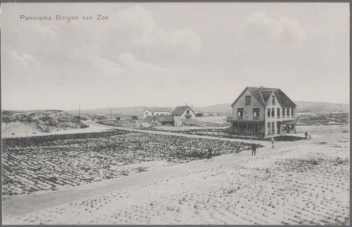
The oldest map of Bergen aan Zee is the one landscape architect Leonard Springer drew in 1907 for the Van Reenen family. It is the design for the "Bergen aan Zee villa park", and it was the basis for the whole village until 1940. It shows only labels such as sports ground, steam tram, station, hotel and villa. Springer included the three buildings that already stood: guesthouse-café Prins Maurits, villa Ulysses and restaurant Nassau. In 1908 H.P. Berlage worked out the area between the Zeeweg and the future tramline, with a dense, closed village centre. His bird's-eye panorama shows how he imagined it.
From spider-web map to walking map
Then came map after map. In March 1909 the first VVV guide to Bergen and Bergen aan Zee appeared, with two maps by P. Rus that we would now call spider-web maps. A walking map from the same year calls Bergen aan Zee "the youngest seaside resort in the Netherlands" and has just three street names. A planning map followed in 1922, a sketch map by architect P. Elders in 1928, a walking map in 1934 on which Bergen aan Zee is a complete village for the first time, and a VVV map by Majella Cijffers in 1937. The last pre-war map, made by the BEM in 1940, was later used to show which buildings were demolished in 1943.
Private roads
For a long time the roads were private property of the BEM. That is why they are missing from the public registers. Residents contributed to their upkeep, parking on the verges was forbidden, and the Van Reenens imposed all sorts of special conditions, known as the Van Reenen easements.
Where the names come from
Many streets are named after people from the early days: Van der Wijck and Van Hasselt, Patijn and Kalff of the Holland Railway Company, Pier Pander and C.F. Zeiler. Before the war most streets were still called "straat": Van Hasseltstraat, Rehbockstraat, Pier Panderstraat, Parkstraat. The Van Eedenstraat, named after the writer Frederik van Eeden, who walked through the village with Mrs Van Reenen around 1912, became the Paulineweg after the war. On a map of 1909 the Julianalaan was still the Melis Stokeweg; on 8 December 1943 it was renamed Dennenlaan. On 2 January 1946 the Boulevard became the C.F. Zeilerboulevard, after the founder of Nassau-Bergen.
Some streets have vanished. The Michahellesstraat, named after a Hamburg couple who stayed at Nassau-Bergen in 1909 as some of the very first foreign guests, appears on maps from 1911 to 1922. The narrow Sterkenstraatje led to the Sterken family's tea pavilion. The brick path to the beach, first the Piet Heynweg and later the Druivesteijnstraat, was known locally as the "Kloonie path", because the children from the holiday homes walked along it to the sea.
Never built
The maps of 1922 and 1940 also show streets that never came, north of the village and in the dune valley to the south. On a planning map of around 1970 they are called Meeuwenlekken, Kaapduin, Takkenberg and Lakemansvlak. In 1981 those dunes were permanently designated as nature.
In 1995 the village got three new streets, on Bello's old yard and in the Kuil. They were named after people from the very beginning: the Baan van Ravenhorst, after Mees Ravenhorst, the first permanent resident; the Bakhuisduintjes, after works supervisor Albert Bakhuis, who laid out the Zeeweg and the Parnassiapark; and the Dal van Haasbroek, after Dirk Haasbroek, bookkeeper of the BEM for more than forty years.